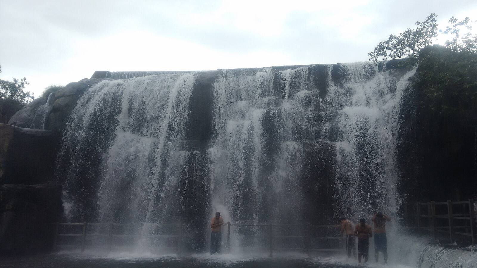
Thirparappu Falls spilling in a broad white curtain over a dark rock shelf on the Kodayar river.

Kanyakumari district · Nature trail

Water, Wind and Shore

A nature trail of Kanyakumari in three loops: the southern tip at first light, the tanks, estuary and sunset coast, and the dams and falls of the Western Ghats.

Photo: Naagesh2509, CC BY-SA 4.0

The district

How water shapes Kanyakumari district

Kanyakumari district is a short, steep slope. The Western Ghats stand along its north and west, and every river that starts there runs down to a coast where three seas meet.

The rivers have been put to work for more than a century. Pechiparai on the Kodayar was built between 1897 and 1906 under the Travancore rulers, Mukkadal followed in 1945, Perunchani in 1948 to 1953 and Chittar II in 1964 to 1969. Below the dams, a chain of village tanks holds the water on the plains. Two of them, the Suchindram and Theroor tanks beside the Nagercoil road, were named a Ramsar wetland on 8 April 2022. At the coast the Pazhayar and the Kuzhithurai river end in estuaries, and wind from the gap in the Ghats at Aralvaimozhi turns the turbines at Muppandal.

The monsoon logic is simple, and it decides when to go. The south-west monsoon, June to September, drops its heaviest rain on the Ghats side, so the falls and dams there run strongest, and on the coast the sea is rough. The north-east monsoon, October to December, rains mainly on the plains and the east, refills the tanks and brings migrant waterbirds that arrive from September to November and stay to March or April. Kanyakumari town itself is comparatively dry, but much of the district receives both monsoons: Thengapattanam averages about 2,058 mm over about 104 rain days.

The trail is paced for travellers who prefer a few places seen well to many seen quickly. Each loop starts early, travels by private car with a driver, and leaves the afternoon open. Where a stop is easier with a naturalist, a boatman or a packed breakfast, the notes say so. Where the sources could not confirm hours, fees or permits, the page says to confirm locally and does not guess.

3LoopsA half day, a day and a full day
2MonsoonsEach one fills a different side of the district
170Bird speciesNearly 170 in the January 2024 wetland census
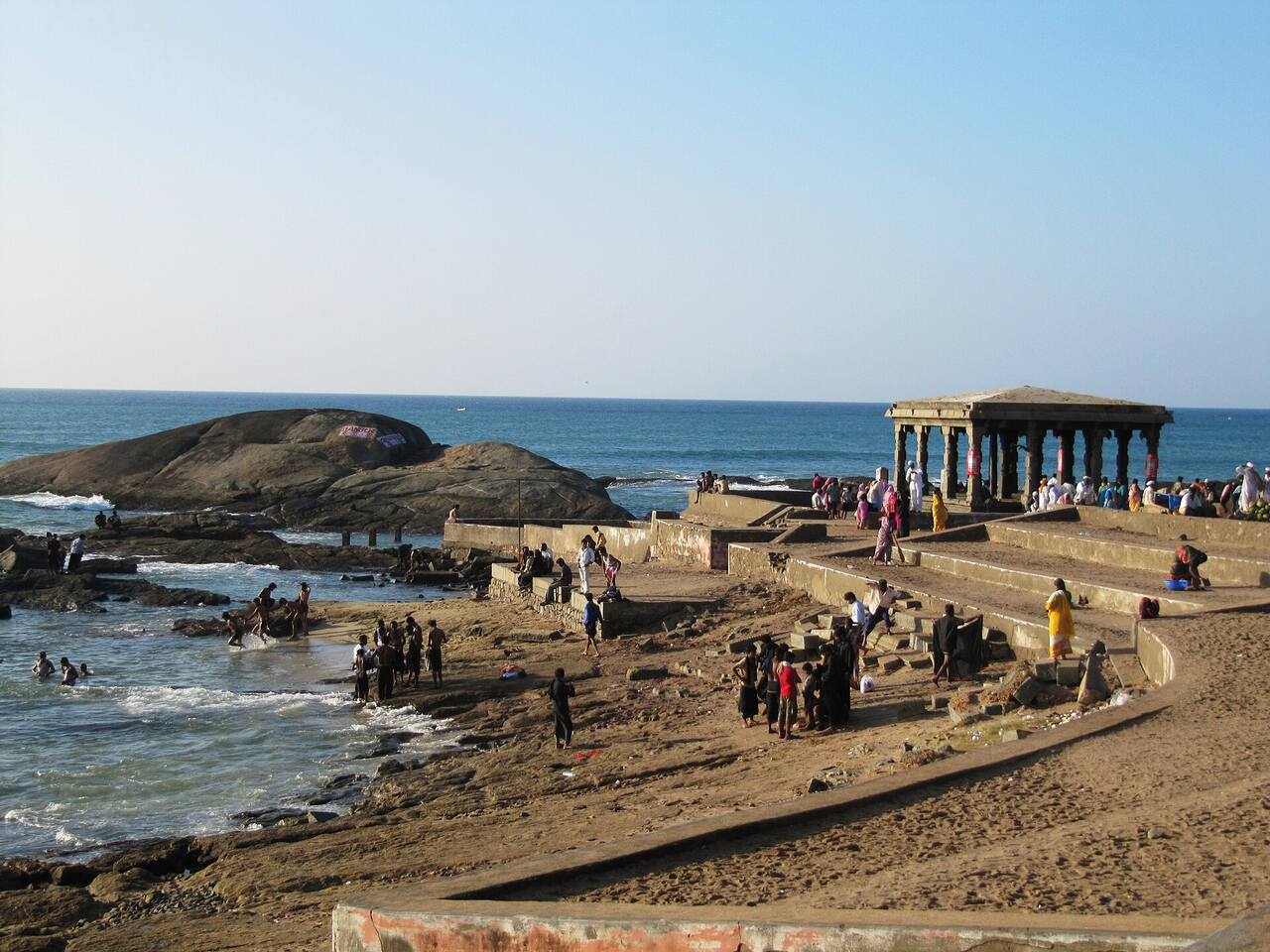
The bathing ghats and a small pillared mandapam on the shore at Kanyakumari, with rocks and the sea beyond.
The shore at Kanyakumari, where the three seas meet

The trail

Three loops from Kanyakumari

Distances are from Kanyakumari town and are approximate unless a source is named: they are road estimates from travel pages and reference sources, not surveyed measurements. Each stop carries a "Know before" line that holds only what the sources confirmed. Where they did not, it says to confirm locally. Read the safety notes in the practical section before you go.

Loop at a glance

Stops and distances

Stops and distances
Kanyakumari sunrise point0 km
VattakottaiAbout 7 km
Marunthuvazh MalaiAbout 10 km
Muppandal wind plainsAbout 25 to 30 km

Southern tip at first light

Half day · about 60 km round trip (approximate)

  1. Before dawn · 0 km

    Kanyakumari sunrise point

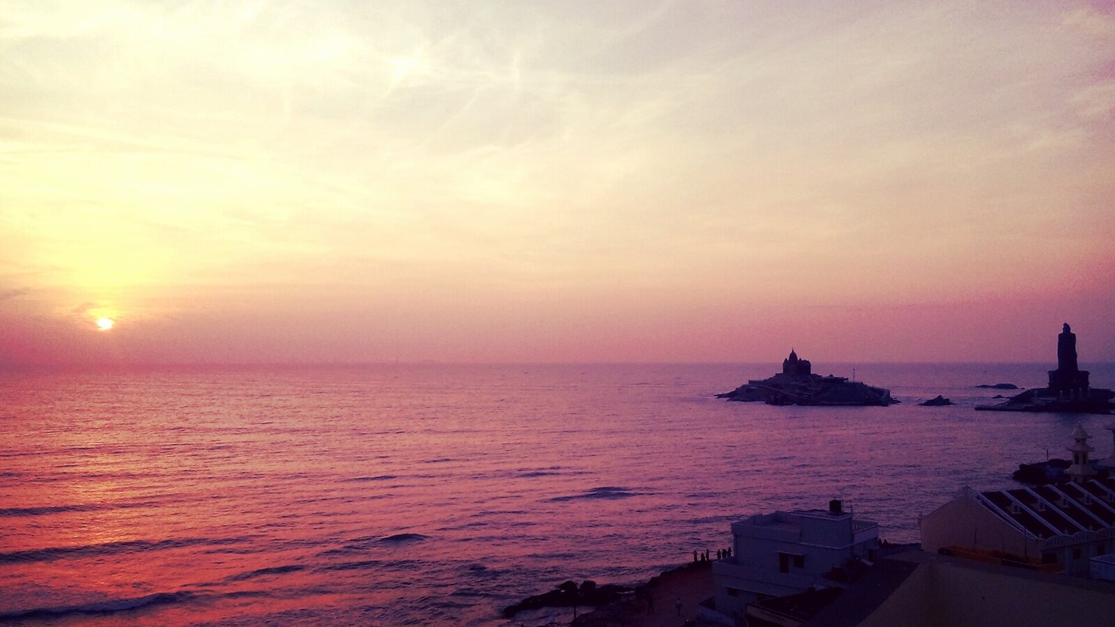
    The town's own sea-edge viewing points, where three seas meet: the sun rises over the Bay of Bengal and sets over the Arabian Sea. On clear mornings it comes up beyond the two rocks. Sunrise falls at roughly 05:45 to 06:30 depending on the season (approximate), and cloud in the north-east monsoon often spoils the horizon. On Chitra Pournami, the April or May full moon, the sun sets in the west just as the full moon rises in the east. In 2026 that fell around 1 May near 18:00, with Triveni Sangamam, Sunset Point and Murugan Kunram named as viewing places.

    Know beforeOpen public viewing, and crowded at pournami. The sea near the confluence is rough. Sea bathing was banned on 18 February 2025 after waves of 10 to 15 ft, and a high alert for rough seas was issued on 14 February 2026. Boat service to the rock memorial is often halted in rough weather. A hotel with a terrace or roof spares you the beach crowd.

  2. About 7 km · first light

    Vattakottai sea view

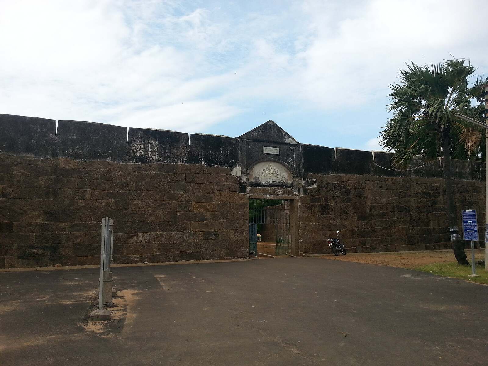
    An 18th-century Travancore granite seaside fort, protected by the Archaeological Survey, with a section that runs out into the sea. It has sea on one side and the Ghats on the other, with a black-sand beach beside it. The ramparts give a free view of the rocky shore in early light. The fort belongs equally to the heritage trail, which has the history.

    Know beforeOpening hours and ticket price were not found in the sources read; confirm locally, and ask whether the gate opens early enough for dawn. About 15 minutes by car.

  3. About 10 km · early morning

    Marunthuvazh Malai

    A hill of about 800 ft at the southern tip of the Western Ghats, near Pothaiyadi, with caves and shrines along the path. Reference sources say the summit shows the V of the subcontinent, three seas and coconut palms. Local legend holds that the hill is a fallen piece of the Sanjeevi mountain, which is why it is called the hill of herbs. One visitor account puts the climb at about two hours.

    Know beforeHours, fees and permits were not found; confirm locally. A religious site, so dress modestly. The surface is rocky, so carry water. Sources give 7 to 10 km from town. Go at dawn with a local guide from Pothaiyadi and plan breakfast afterwards.

  4. About 25 to 30 km · late afternoon

    Muppandal wind plains

    Turbines have stood here since 1986, and the Muppandal farm is described as India's largest operational onshore wind farm, at about 1,500 MW installed. They rise beside the highway, so much of the view is available from the car. A travel guide credits the Aralvaimozhi Pass, a gap in the Ghats, with funnelling the wind. Evening light across the open plains is the reason to come, so this stop can wait for the afternoon.

    Know beforeRoadside viewing only; no visitor centre was found, and the land around the turbines is private, so do not enter it. Ask the driver to choose a safe lay-by. About 20 km in a straight line and about 25 to 30 km by road (approximate). Return by the Aralvaimozhi road.
Loop at a glance

Stops and distances

Stops and distances
Suchindram and Theroor tanksAbout 12 km
Manakudy estuaryAbout 15 km
Sothavilai beachAbout 14 km
Muttom lighthouseAbout 32 to 34 km
Thengapattanam (optional)About 55 to 65 km

Tanks, estuary and sunset coast

One day · about 90 km (approximate)

  1. About 12 km · dawn

    Suchindram and Theroor tanks

    A pair of freshwater and brackish tanks on the Nagercoil road, part of the Suchindrum-Theroor-Manakudi Conservation Reserve and a Ramsar site since 8 April 2022. They lie at the southern end of the Central Asian Flyway and are an Important Bird Area. Garganey and purple heron are named. The wetland census of 28 January 2024 recorded nearly 170 species and about 15,000 birds across 25 wetlands in the district. Migrants arrive from September to November and stay to March or April, and December to February at first light is the best time.

    Know beforeRoadside viewing; no ticketed entry was found. The forest department controls the reserve. Hours and any fee were not verified, so confirm locally. The distance is my own estimate from the temple town's position on the road, not a sourced figure. Take binoculars, a scope and a flask, and ask the forest department or a regional naturalist for a local birder. The Suchindram temple, on the heritage trail, is close by.

  2. About 15 km · morning

    Manakudy estuary and mangroves

    The Pazhayar meets the Arabian Sea here among salt pans, mudflats and about 30 ha of mangrove, inside the Conservation Reserve declared in 2021. Reports list painted storks and grey herons in the shallows, waders such as little stint and plovers, and flamingos on the salt pans. A 2021 news report described tagged Arctic waders on the reserve. October to March is the migrant season, tide permitting.

    Know beforeBoat rides leave from near the bridge. Reviews describe ordinary rides that do not enter the mangroves, and the Forest Department's official boating rules and fares could not be verified, so confirm locally. Five speedboats have run on the lake since 2023, and sewage and plastic pollution were reported in 2025. Hire a private boatman at dawn rather than taking a speedboat, and do not expect access inside the mangroves. About 30 to 40 minutes by car.

  3. About 14 km · late morning

    Sothavilai beach

    A beach of about 4 km near Manakudy with sand dunes stretching back from Manakudi. It is open and little developed, which makes it a walk rather than a swim. The 2004 tsunami hit it badly. Walk at first light and have the car meet you at the far end.

    Know beforeNo fee was reported. The waves are called dangerous, risky for adults and unsuitable for children, and warning signs against swimming are reported. Few restrooms. Travel pages give 10 to 17 km from town; 14 km is the figure most often repeated. About 30 minutes by car.

  4. About 32 to 34 km · sunset

    Muttom rocks and lighthouse

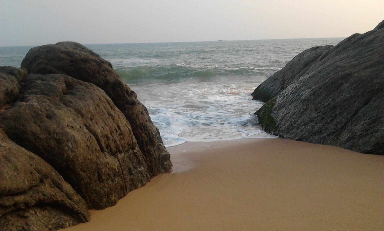
    A fishing-village beach with large boulders on both sides, a British-era lighthouse built between 1857 and 1882 and 110 ft tall, and a teri dune complex. The rocks break the surf into spray, and the sunsets are ranked among the best in the district. A search result reports that the lighthouse opens for a small fee and that a maritime heritage museum opened there in 2017. Arrive for the last hour of light.

    Know beforeThe lighthouse's visiting hours were not verified; check them with the Directorate of Lighthouses and Lightships. Do not swim around the rocks. Sea-surge alerts closed Kanyakumari-coast beaches in February 2025 and February 2026. About 50 minutes by car, and about 35 km back along the coast road.

  5. Optional · about 55 to 65 km

    Thengapattanam estuary

    A river-mouth town where the Kuzhithurai river, the Thamirabarani, enters the Arabian Sea, with ferry history on the AVM Canal. A 2023 field-trip report saw mangroves from a hired boat. It suits a slow late afternoon on a long, open shore, from November to February when the water is calmer.

    Know beforeBoats are arranged through local fishermen; no official fares or hours were found, so confirm locally and arrange it through the hotel. Treat the river mouth and the surf as unsafe for bathing. The distance is my sum from a reported 35 km from Nagercoil, about 1 h 30 to 1 h 45. Thirparappu falls is about 20 km away (approximate).

Loop at a glance

Stops and distances

Stops and distances
NagercoilAbout 20 km
Mukkadal dam (optional)About 30 km
Thirparappu fallsAbout 50 to 55 km
Chittar damsAbout 58 km
Pechiparai damAbout 60 km
Perunchani damAbout 62 km

Western Ghats water

Full day · about 130 km round trip (approximate)

  1. About 20 km · early start

    Nagercoil

    The district town is the last place for supplies and the base for the forest office. Have the hotel pack breakfast and a picnic lunch: there is no hospitality at the dams, and the falls offer little. Nagercoil is about 20 km from Kanyakumari (approximate, a commonly quoted figure).

    Know beforeIf you plan the forest-edge variant below, confirm with the forest office in Nagercoil before you leave.

  2. Optional · about 30 km

    Mukkadal dam

    An earthen dam of clay and granite on the Vambaru river, built in 1945 by the Travancore king, which supplies water to Nagercoil. Forested hills stand on three sides and a park is mentioned beside the dam. It is worth a pause on the way north, but not a trip of its own.

    Know beforeOwned by the Nagercoil Municipal Corporation. Travel blogs claim boating, which the reference sources do not confirm. Hours and fees were not verified, and a drinking-water reservoir may restrict access, so confirm locally. About 10 km from Nagercoil, so about 30 km from Kanyakumari (my sum).

  3. About 50 to 55 km · at opening

    Thirparappu falls

    A cascade of about 13 m and some 300 ft wide on the Kodayar river near Kulasekharam, with a stone mandapam and a Mahadeva temple close by. It is the one easy, road-accessible cascade in the district. The river spreads across a broad rocky bed, so the sound is a wide roar rather than a single drop. The drive from Thuckalay runs through rubber and banana plantations with the Ghats ahead. It is fullest during and after the south-west monsoon and with north-east rain, and thin from February to May.

    Know beforeThe district site lists 06:00 to 18:00 daily with no fee on that page; other pages give a fee between nothing and Rs 15 and different hours, so confirm locally. Bathing and entry were banned on 16 July 2024 when Pechiparai water flooded the falls, and bathing restrictions recur in heavy rain. Treat bathing as unsafe whenever Pechiparai is releasing water. Go on a weekday at opening and avoid weekends and the Deepavali and Pongal holidays. About 1 h 30 by car.

  4. About 58 km · midday

    Chittar dams I and II

    Two earthen dams about 1.5 km apart on the Chittar river. Chittar II was built between 1964 and 1969 and is 1,134 m long. The lake is broad, with the Ghats foothills behind. A travel blog reports a fish landing near the dam at about 08:00, which is unverified. Chittar I is the quieter of the pair, and a pleasant midday stop between falls and dams.

    Know beforeTimings and fees are not stated on the district page. Boating is not confirmed, and sources disagree on whether it is a tourist site. Permits were not verified. Plan a hotel-packed lunch. About 1 h 30 to 1 h 45 by car.

  5. About 60 km · afternoon

    Pechiparai dam

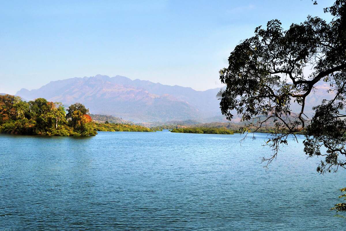
    A masonry reservoir on the Kodayar, built between 1897 and 1906 under the Travancore rulers and set against forested hills with few buildings. Its releases feed Thirparappu downstream. The setting suits a picnic and slow views rather than activity. It is fullest from September to December, and low in April and May. Morning light and early evening are best.

    Know beforeThe district page leaves timings and fees blank, and boating status was not verified. Bathing in the reservoir has been banned in flood spells. Telephone the Tourism Department on 9176995866 (the number listed on the district site) the day before to ask about gate hours and boating. The district site gives about 13 km between Thirparappu and Pechiparai, while the Kanyakumari figures imply about 8 km; ask your driver. About 1 h 45 by car.

  6. About 62 km · late afternoon

    Perunchani dam

    An irrigation dam on the Paralayar river, built between 1948 and 1953, with a small hydro station added in 2005 and 2006. Sources describe a thickly forested reservoir between two hills, with the Kanikar tribal community living around its edges and the road ending in Veerapuli reserve forest. It is quiet and uncommercial, and fullest from October to January.

    Know beforeTimings are blank on the district page and no fee is stated. Permit requirements were not verified, so confirm locally. Elephant and gaur are recorded in the wider area, so do not walk into the forest. Bring your own shade and water, since no facilities were confirmed. About 1 h 45 to 2 h by car. Return the same way.

Highlights

Six views to keep

The wide blue Pechiparai reservoir with a forested islet and hazy Western Ghats peaks behind, a tree branch framing the right edge.

Loop III

Pechiparai reservoir

A masonry dam of 1897 to 1906 holds back a wide sheet of water against forested hills. Morning light and early evening show it best.

Sunrise over the sea at Kanyakumari, with the rock memorial and statue in silhouette on the horizon.

Loop I

The sunrise point

On a clear morning the sun comes up over the Bay of Bengal beyond the two rocks. Cloud in the north-east monsoon often hides the horizon.

The granite gateway and laterite ramparts of Vattakottai Fort under a pale sky.

Loop I

Vattakottai, the sea view

The fort is the second stop of Loop I, with the sea on one side and the Ghats on the other. The ramparts give a free view of the rocky shore in early light.

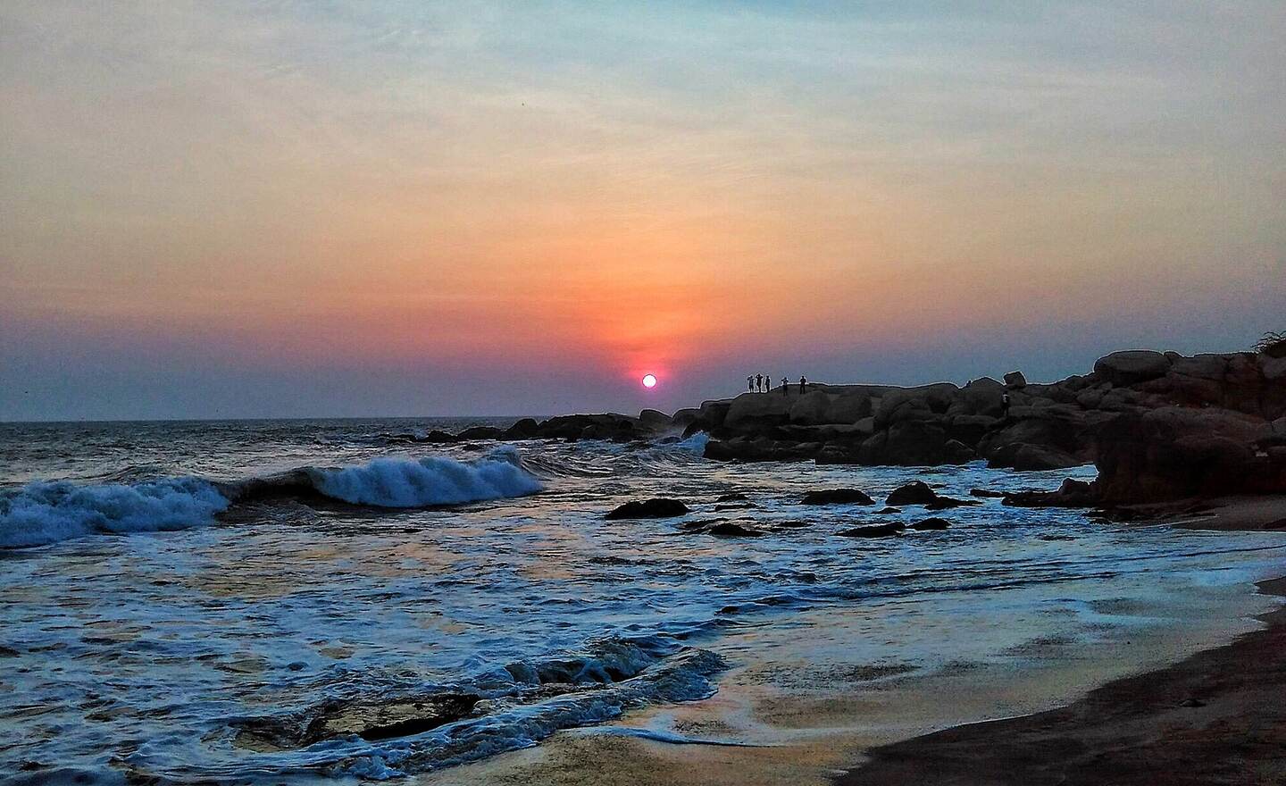
The sun setting into the sea beyond a rocky shoreline, waves rolling in blue and orange light.

Loop I

The sunset point

The sun sets over the Arabian Sea at the town's own viewing points. On Chitra Pournami it sets as the full moon rises.

Gold sand between two large dark boulders at Muttom, with waves breaking beyond.

Loop II

Muttom at sunset

Large boulders break the surf into spray on a fishing-village beach. Watch from the sand, not from the rocks.

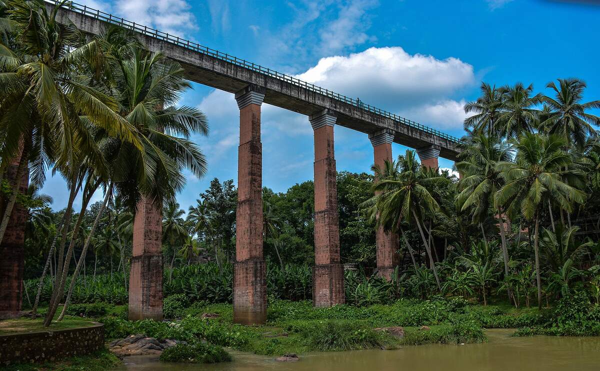
The long Mathur aqueduct carried on tall slender piers above a dense canopy of coconut palms.

Off the trail

Mathur's trough over the valley

Mathur is a short detour covered in the five-day itinerary, not a stop on this trail. Walk along the trough for the best view of the Pahrali valley canopy, and bring a hat, as there is little shade.

Practical notes

Before you go

Safety first

  • Sea bathing at Kanyakumari was banned on 18 February 2025 after sudden waves of 10 to 15 ft, and a high alert for rough seas followed on 14 February 2026. Look at the sea; do not enter it.
  • Do not go to Lemur Beach. It is a closed private beach where five medical students drowned on 6 May 2024 after sea-surge warnings, according to news reports.
  • Thirparappu falls was closed to bathing and entry on 16 July 2024 when Pechiparai water flooded it. Bathing is unsafe whenever Pechiparai is releasing.
  • Sothavilai and Muttom are for walking. Do not swim there or around the rocks.
  • The Kalikesam river has claimed many lives; treat it as a view.

What to carry

  • Sun: a hat, sunscreen and shade. Midday is hot from March, and the wind plains and Chittar dams offer little cover.
  • Water and food from the hotel. Nothing is confirmed on sale at Perunchani, and Vattaparai has one small tea stall.
  • Leeches: long trousers and closed shoes for forest paths in the wet months. Leeches are likely then, though the sources read do not document them.
  • Binoculars, a scope and a flask for the wetlands.
  • A rain layer from October to December, and offline maps for the Ghats, where mobile signal is weak.

Permits and access

  • Kalikesam: permission from the Forest Officer, Nagercoil, and a ticket at the Keeriparai check post.
  • Ulakkai Aruvi, Vattaparai and the sanctuary interior: permit status could not be verified. Confirm with the forest office in Nagercoil, and do not promise yourself interior access.
  • Tamil Nadu forest rules say trekking and camping need approved eco-tourism zones and prior permission (a search result of the forests department FAQ).
  • Suchindram-Theroor and Muppandal are roadside viewing. The land around the turbines is private.
  • Hours and fees at Pechiparai, Perunchani, Chittar and Vattakottai are blank or unverified. The Tourism Department number on the district site is 9176995866.

Boating

  • Manakudy: boats leave near the bridge. Official rules and fares are unverified, and rides may not enter the mangroves.
  • Thengapattanam: boats through local fishermen, with no official fares found.
  • Pechiparai, Chittar and Mukkadal: boating is claimed by some pages and not confirmed. Ask before you plan around it.
  • Boats to the rock memorial at Kanyakumari are often halted in rough weather.

Conduct

  • Marunthuvazh Malai and Kalikesam are religious sites, so dress modestly.
  • Do not walk into forest on the Perunchani or Keeriparai roads; elephant and gaur are recorded in the wider area.
  • Keep out of the turbine fields at Muppandal.
  • Take plastic and food waste away with you.

Luxury pacing

  • Book a private car and driver for the day, with a naturalist or local birder through the forest department or a regional guide for the wetlands.
  • Hire a private boatman at dawn for Manakudy, and ask the forest range for a naturalist.
  • Have the hotel pack breakfast and lunch for the Ghats, where there is no hospitality, and take the stone mandapam at Thirparappu for breakfast on a weekday.
  • Ask the forest office in Nagercoil to arrange a guide and an eco hut booking, and reach any check post before it closes.
  • Keep the afternoons open. Loop I is a half day, and the other two start early.

Season calendar

What the district is doing, month by month
MonthConditions
JanuaryDry and clear. The best month for wetland birds, Ghats walks and Muttom sunsets. Falls at moderate flow after north-east rain.
FebruaryDry and warm. Wetland birds still present. The sea can swell (alert of 14 February 2026). Good for the forest edge.
MarchHot by midday. Migrants leaving and reservoirs falling. Mornings only.
AprilHot and humid. Chitra Pournami sunset and moonrise at Kanyakumari. Most birds gone and falls thin.
MayThe hottest month, with the south-west monsoon arriving. The wind farms start to turn. Avoid Ghats climbs.
JuneSouth-west monsoon begins. Rough sea and surge, rising falls. Bathing restrictions at Thirparappu are possible.
JulyHeavy Ghats rain and flood-level releases from Pechiparai (the 16 July 2024 ban). Scenic but wet. Do not bathe.
AugustMonsoon continues. Expect leeches in forest. Dramatic drives across the wind plains.
SeptemberMonsoon easing. First migrants arrive on the tanks and reservoirs are full.
OctoberNorth-east monsoon starts. Rain on the plains, wetlands filling, falls and dams full.
NovemberShowery. Migrants well settled and the Ghats green. The start of the best touring season.
DecemberClear and pleasant. Peak birds and full reservoirs, with fairly high visitor numbers around the holidays.

Drive times from Kanyakumari

Approximate drive distances and times for each loop
LoopRound tripFarthest stop
I. Southern tipAbout 60 kmMuppandal, 25 to 30 km, about 45 min
II. Tanks and coastAbout 90 kmMuttom, 32 to 34 km, about 50 min
II. with ThengapattanamAdd about 60 to 70 km55 to 65 km, 1 h 30 to 1 h 45
III. Ghats waterAbout 130 kmPerunchani, 62 km, 1 h 45 to 2 h
III. forest-edge variantConfirm with the forest officeKalikesam, about 55 km, 1 h 30 to 1 h 45

All figures are approximate planning numbers: summed one-way distances from the sources, not measured road legs. Add time for narrow Ghats roads and for the check posts.

Sources

Checked November 2026

Every address below was consulted in November 2026. Pages marked "search result only" were seen as a search snippet and not opened in full, so treat what they contributed as unconfirmed. The district site leaves many hours and fees blank, and the Tamil Nadu Tourism and Ramsar pages could not be reached. Two news reports of the May 2024 drownings were also seen only in search results. Confirm locally, especially around monsoon releases.

  1. Kanniyakumari District: Thirparappu falls
  2. DT Next: bathing ban at Thiruparappu falls
  3. Wikipedia: Kanyakumari district
  4. Atlas Obscura: Thirparappu waterfalls · search result only
  5. Kanniyakumari District: Pechiparai dam
  6. Wikipedia: Pechiparai Dam
  7. DT Next: Pechiparai overflow floods Thiruparappu falls · search result only
  8. Kanniyakumari District: Perunchani dam
  9. Wikipedia: Perunchani Dam
  10. Kanniyakumari District: Chittar II dam
  11. Tamil Nadu Tourism: Chittar Lake · search result only
  12. Wikipedia: Mukkadal
  13. MyKanyakumari: Mukkadal dam · search result only
  14. Wikipedia: Ulakkai Aruvi Waterfalls
  15. TripXL: Ulakkai Aruvi waterfalls · search result only
  16. Kanniyakumari District: Kalikesam
  17. Wikipedia: Kalikesam
  18. Tamil Nadu Forest Department: Kalikesam eco hut · search result only
  19. Wikipedia: Vattaparai Falls
  20. Kanyakumari Tourism: Vattaparai Falls · search result only
  21. Wikipedia: Kanyakumari Wildlife Sanctuary
  22. Tamil Nadu Forest Department: FAQs · search result only
  23. Wikipedia: Suchindram Theroor Wetland Complex
  24. DT Next: 170 species listed in the bird census
  25. Ramsar Sites Information Service: site 2492 · search result only
  26. DT Next: tagged Arctic birds at Manakudy · search result only
  27. Webjosh: Manakudy mangroves face pollution risk · search result only
  28. India Environment Portal: Manakudy eco-conservation park report · search result only
  29. Wikipedia: Thengapattanam
  30. Blackbuck Nature Society: Thamirabarani · search result only
  31. Tamil Nadu Tourism: Thengapattinam beach · search result only
  32. Wikipedia: Sothavilai Beach
  33. Veena World: beaches in Kanyakumari · search result only
  34. Wikipedia: Muttom, Kanyakumari
  35. Directorate of Lighthouses and Lightships: Muttom Point · search result only
  36. Kanniyakumari District: Muttom beach · search result only
  37. Wikipedia: Marunthuvazh Malai
  38. MyKanyakumari: Marunthuvazh Malai · search result only
  39. Wikipedia: Muppandal Wind Farm
  40. Mongabay India: the wind farm paradox in southern Tamil Nadu · search result only
  41. Travelsetu: Muppandal and the Aralvaimozhi Pass · search result only
  42. Wikipedia: Vattakottai Fort
  43. DT Next: sunset and moonrise on Chitra Pournami
  44. DT Next: bathing ban as the sea turns rough
  45. Hindusthan Samachar: high alert across Kanyakumari · search result only

Enquiries

Follow the nature trail with us

Send your dates and the loops you want. We arrange the chauffeur, a naturalist or boatman where one is worth having, and the forest permits that need lead time.

WhatsApp +91 89717 44883 Call +91 89717 44883

Calls and WhatsApp, India time. One number for every lineup.

WhatsAppCall